Big Severe Weather Event Coming Through!
- Phillip Edwards
- Mar 29, 2022
- 2 min read

TUESDAY

This week we will see a round of severe weather marching its way across the country starting on Tuesday night and continuing through Thursday evening. Storms will start to fire up along a triple point surface low around 7-8pm Tuesday night in central Kansas and will track to the northeast through northeast Kansas, southeast Nebraska, and southwest Iowa. The main threat with these storms will be damaging wind and hail, although there is the chance for a tornado or two. With the first few storms, especially in northeastern Kansas, a super cellular mode will be persistent, but a large capping inversion could possibly suffocate these storms before they get a chance to really get going.
Later in the evening around 10pm the cold front will push through creating another round of storms, probably more linear, through east central Kansas and extending down all the way to south central Texas. The biggest threat with these storms will be damaging wind and large hail, although a few tornadoes could be possible through central Oklahoma where the low-level jet will be cranking.
WEDNESDAY
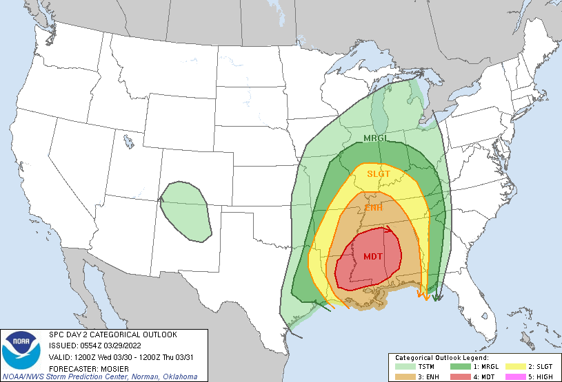
Wednesday is looking really bad for anyone living in Mississippi and surrounding states. All the ingredients are coming together for a large-scale tornado outbreak. If you know anyone in the area, make sure to tell them to listen to the weather reports and have a safe shelter ready! The line of storms that will be forming tonight in Texas/Oklahoma will be moving through Missouri, Arkansas, and eastern Texas overnight tonight and reaching the Louisiana-Mississippi area around 12-2pm tomorrow. Be ready for extreme weather!
THURSDAY
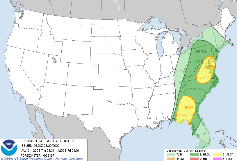
This same system will eventually reach the east coast on Thursday bringing with it the treat for damaging winds and hail. The storms will reach Georgia early Thursday morning, while the mid-Atlantic won't see much action until Thursday evening. A threat for tornadoes still looks evident through the Florida panhandle into southern Georgia, but the extent isn't known this far out.
Please say it’s going to snow!!!!!
Wow! This is so interesting, can't wait to see what happens with the storm!
Very insightful.
First is the worst second is